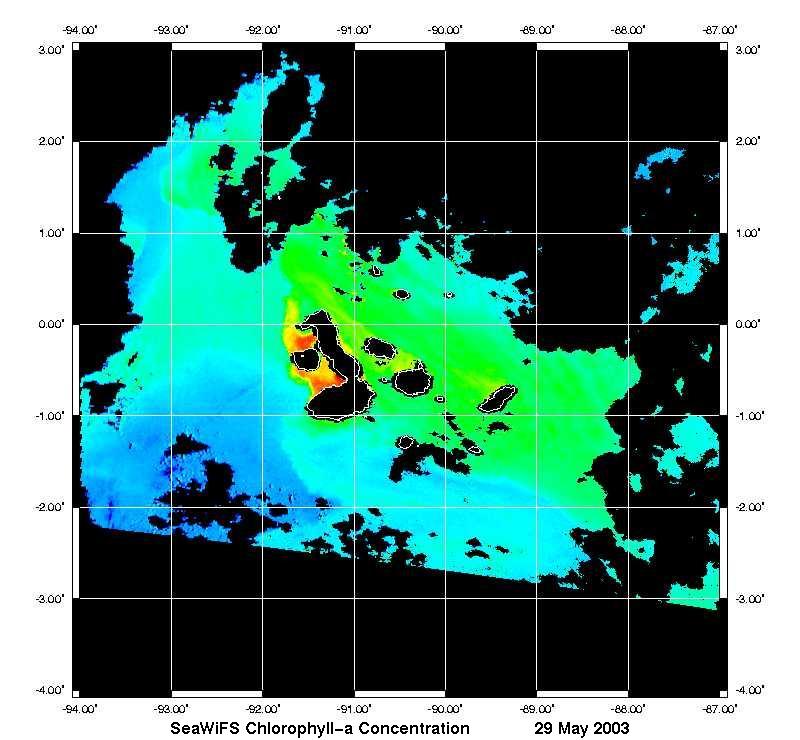
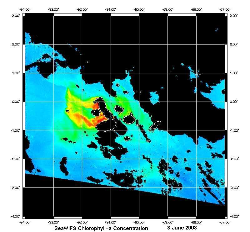
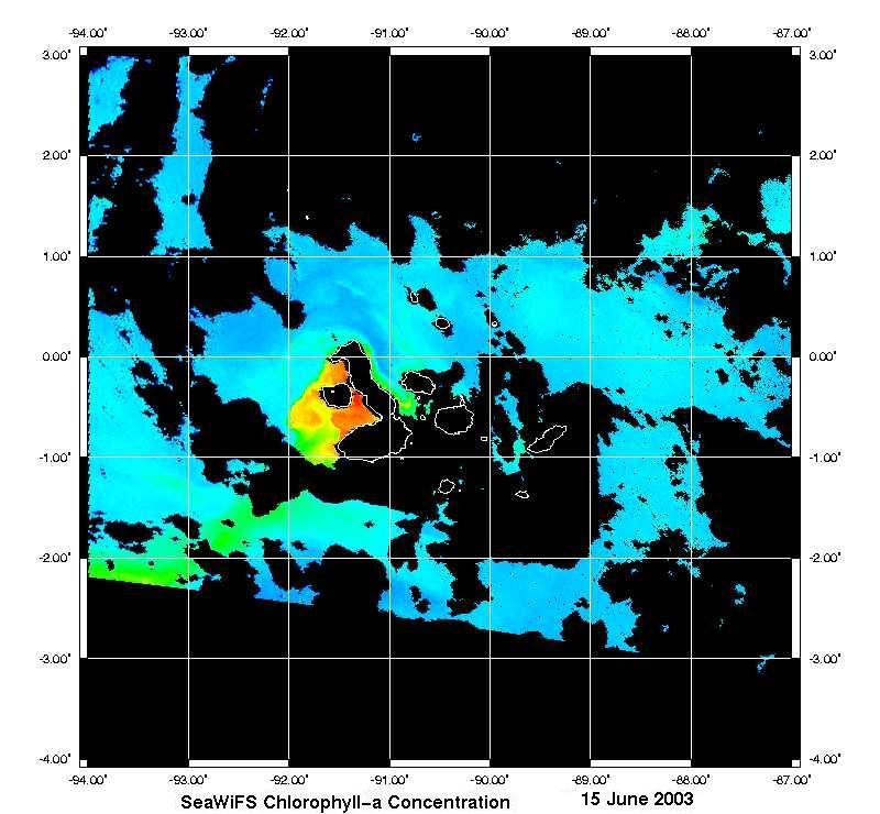
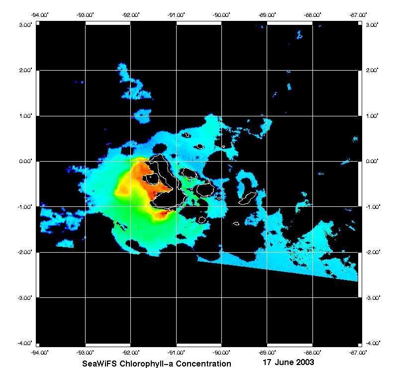
 Over a period of less than two weeks, SeaWiFS captured the development of a large plume of plankton-rich water straddling the equator and extending several hundred kilometers downstream from the island of Isabela in the Galapagos Archipelago.
The large phytoplankton bloom to the west of Isabela Island is a consistent feature, constantly changing in size and shape, that sustains an ecosystem like none other. Nowhere else in the world will corals, hammerhead sharks, flightless cormorants, penguins and fur seals be found upon the same sub tidal reef! Cold water from the submarine Cromwell current deflects against the Galapagos Platform bringing trace elements such as iron into the sunlit coastal waters. This seems to trigger these huge events. To the east wind driven upwelling along the equator also encourages production.
Such high primary production also provides for local semi-intensive sea-cucumber, fin-fish and rock lobster fisheries. The future of the Galapagos marine reserve depends upon the sustainable management of these resources and improved understanding of the natural environment. In an area also renowned for the devastating impact of large El NiF1o events, such human impacts might tip the sensitive balance between extinction and survival. The marine scientists of the Charles Darwin Research Station continue using SeaWiFS data as a valuable tool to assess the part such productivity plays in maintaining the unique biodiversity and endemism in the marine reserve.
The Charles Darwin Foundation (CDF) for the Galapagos Islands works together with the Galapagos National Park Service towards providing the scientific advice needed for sustainable development and management of the Galapagos Marine Reserve. For more information about Galapagos and the ongoing work of the CDF please visit http://www.darwinfoundation.org/.
This sequence of images acquired on May 29th, June 8th and finally on June 10, 2003 not only document the development of the plume in the western part of the region, but also caught the decrease in chlorophyll concentrations in the east. Subsequent images taken on June 11, June 13, June 15 and June 17, 2003 show how quickly conditions around the Galapagos can change.
|

