Ocean Color Image Gallery
Eastern United States Blizzard 2016 |
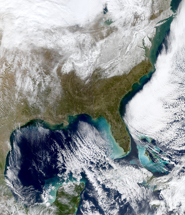
 A clear cloud free moment, just as the blizzard has ended on Sunday January 24 2016, reveals the extent and clear boundary of the footprint of snow left behind on the Mid-Atlantic and Northeast region of the United States. The left (Western half) of the image was taken at 11:50am EST by the NASA MODIS Terra instrument, the right (Eastern half) of the image was taken at 1:30pm EST by the NASA MODIS Aqua instrument. The images from these two satellite observations have been stitched together to give the above composite image. Minor changes can be observed along the joining line up the middle of the image due to cloud movement during the 100 minutes between the satellite observations, as well as due to the differing sun angles. |


