|
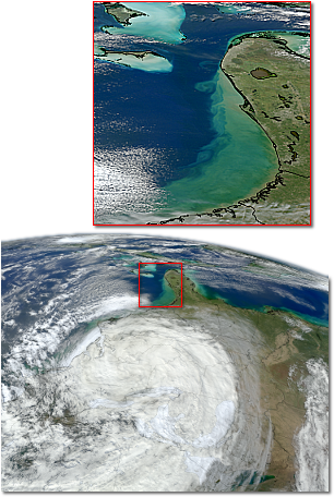
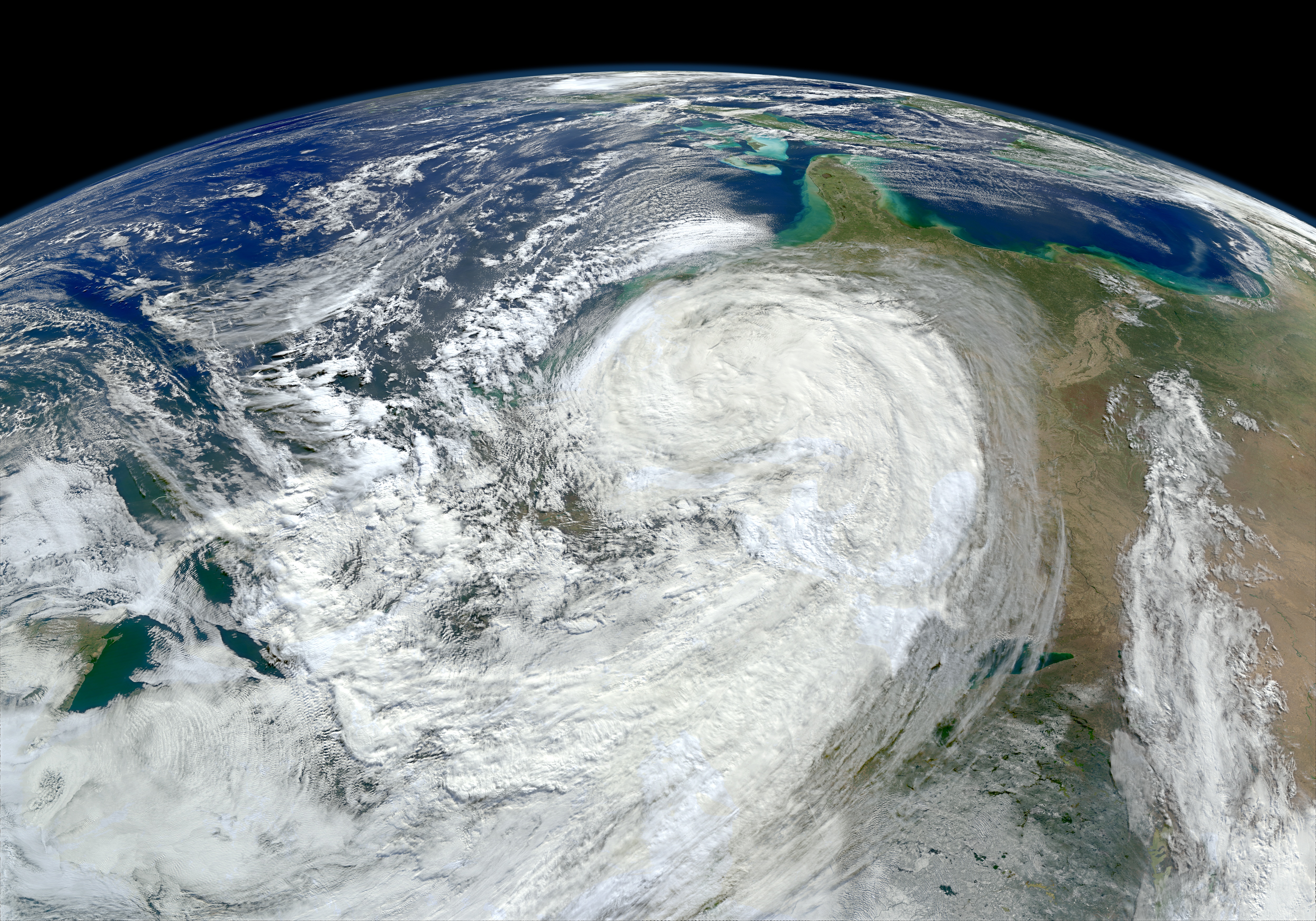
As the large Hurricane Sandy moved north along the U.S. East Coast, the waves it generated churned up sediments from the continental shelf and left turbid water in its wake. By mid day October 30, 2012, the skies over coastal Florida, Georgia, and South Carolina had cleared enough to reveal the turbidity to the orbiting VIIRS instrument on the Suomi NPP satellite. Meanwhile, the remnants of the storm were battering the northeastern states.
Larger versions of the above VIIRS image with and without state borders shown are also available.
|

