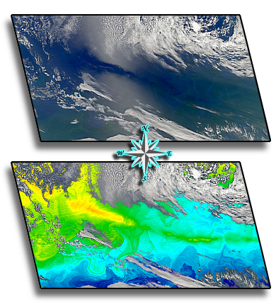

On the right are two views of the same Aqua-MODIS scene over the South Atlantic. The upper panel shows a dark break in the sunlight reflected from the ocean's surface. The lower panel shows a long linear band of elevated sea surface temperature. The two features (visible and thermal) appear to coincide.
Could this be more than coincidence?
Perhaps it could. Roll your pointer over the images to see what other geophysical parameter follows the same line.