![]()
Grace Su ( license@seawifs.gsfc.nasa.gov) (301) 286-9494
Applicant's Name: 	Dr. Walter Geibert
Institution:	 	Alfred Wegener Institute for Polar and Marine Research
Address:		Am Handelshafen 12
			27570 Bremerhaven
			Germany
Telephone:		++49 471 4831 1287
Fax Number:		++49 471 4831 1425
E-mail Address: 	wgeibert@awi-bremerhaven.de


Type of Temporary Agreement requested:

An agreement that temporarily enables a non-real time SeaWiFS HRPT station
to decrypt real-time data and release it to the Authorized Users list.

Time period of temporary agreement:

Dates (month/day/year): 11/27/2002 - 01/21/2003

SeaWiFS HRPT Station to provide data: HAWI (RV Polarstern)

List of Authorized Users to access real-time data.

1. Walter Geibert

Project Title: Synoptical investigation of particle flux in the Eastern Weddell Gyre

Principal Investigator(s): Jill Schwarz

Funding Agency(s): Alfred Wegener Insititute, Deutsche Forschunjsgemeinschaft

Description of the Research Project and Justification for Real-time SeaWiFS Data:
The Weddell Gyre is a permanent ocean circulation pattern that is located south of about 60o S. It extends from the Antarctic Peninsula to about 35o E. In the vicinity of Antarctica, new bottom water is produced, especially in the Weddell Gyre. This mechanism brings seawater that has been in equilibrium with the atmosphere at depth and thus constitutes one of the few links between the atmosphere and the deep ocean. As a complementary water movement, deep upwelling takes place in the Weddell Gyre, bringing deep waters to the ocean surface. The latter process seems to be more intense in the south-eastern part of the Gyre. In contrast to the obvious importance of this region for global ocean circulation, very few data are available from the eastern Weddell Gyre.
Model calculations based on nutrient budgets as well as first data on export production indicate that the eastern Weddell Gyre is a region of surprisingly high nutrient consumption due to biological productivity (Usbeck et al., 2002, G-cubed). However, the results also indicate that this production is rapidly remineralized in the water column and does virtually not reach the sediment. SeawWiFS images do not show correspondingly high chlorophyll signals.
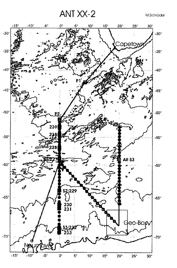
To solve the puzzling question whether there is indeed a high production in the eastern Weddell Gyre that cannot be seen from the satellite, we will perform a cruise to this region, acquiring a comprehensive dataset that will allow quantitative conclusions about the productivity of this poorly known region. The planned cruise track is seen in the attached figure.
The dataset will comprise oceanographic data (temperature, salinity, oxygen, nutrients), flourimetric determination of the vertical chlorophyll distribution, several natural radionuclides that allow conclusions about particle export, deep upwelling, lateral transport of water masses, and sediment samples, that will - in combination with long-lived natural radionuclides - give information about the particle fluxes to the sea-floor.
We would like to contribute to an improved interpretation of SeaWiFS images of this poorly known region by directly comparing satellite images, chlorophyll data and nutrient data. We would be glad to add our chlorophyll surface data to the NASA SEABASS database. All other data (and chlorophyll too, if possible) will be made accessible via PANGAEA database (www.pangaea.de), if data are sensitive, after publication.
Region of interest: 34 deg S - 72 deg S; 10 deg W - 32 deg E
Time of cruise: 11/24/02 - 01/23/03
![]()